Re: Response to question above
Author: Steve Carter
Date: 02-27-2010 - 12:36
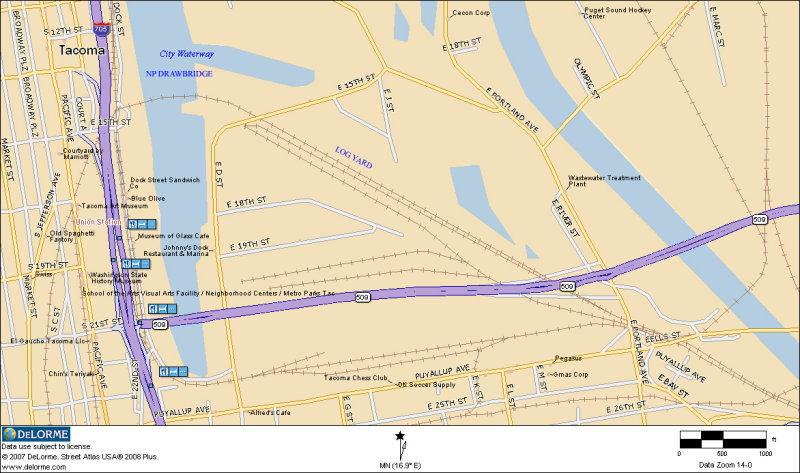
The drawbridge crossed the water way to what BNSF now calls the Log yard. The portion of the tracks on the east side of the water way still exist and when used, serve as a "run around" lead. The appear to be completely level (no grade) and end some 300' from the water. The area on the east side is not readily accessible but views from the west side of the water way show no evidence that there were ever any tracks or bridge. The west side of the bridge is a parking lot for a seafood shop. The water front shows no evidence of a bridge, pilings, etc.
The track off the mains at reservation that would have reached the drawbridge is still called the Drawbridge Lead, running through the log yard and terminating at the east edge of the water way (now called the Foss Waterway).
If I can get this image to post, you can see that Delorme Street Atlas, still shows the drawbridge, log yard, Reservation, Bull Frog Junction, but no signs of the UP yard (NE of the BNSF Log Yard) or the UP's drawbridge across the water way.
Google Earth and/or Bing Maps 3D, can give you a good idea of what it looks like now.
| Subject | Written By | Date/Time (PST) |
|---|---|---|
|
|
Steve Thompson | 02-26-2010 - 17:53 |
|
|
Arlen Sheldrake | 02-26-2010 - 19:18 |
|
|
d | 02-27-2010 - 00:16 |
|
|
Brian | 02-27-2010 - 10:57 |
|
|
Richard Elgenson | 02-27-2010 - 11:49 |
|
|
d | 02-27-2010 - 11:53 |
|
|
Steve Carter | 02-27-2010 - 12:36 |
|
|
Steve Thompson | 02-27-2010 - 12:37 |
|
|
George Andrews | 03-02-2010 - 12:21 |