Alameda Island Map
Author: TMer
Date: 01-09-2021 - 22:12
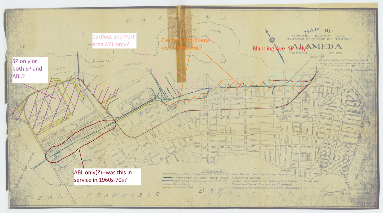
Here's a map from the Kansas Historical Society. It's from 1951. The SP ran down Lincoln Avenue when this map was drawn but later that portion of their trackage was abandoned (franchise expired?) and the SP started running on Alameda Belt Line tracks on Clement Avenue.
I drew a few questions on the map. Maybe someone knows the answers?
[www.kshs.org]
I drew a few questions on the map. Maybe someone knows the answers?
[www.kshs.org]
| Subject | Written By | Date/Time (PST) |
|---|---|---|
|
|
TMer | 01-09-2021 - 22:12 |
|
|
Dave B | 01-09-2021 - 22:38 |
|
|
OPRRMS | 01-09-2021 - 23:11 |
|
|
TMer | 01-09-2021 - 23:32 |
|
|
OPRRMS | 01-10-2021 - 00:10 |
|
|
FUD | 01-10-2021 - 12:48 |
|
|
OPRRMS | 01-10-2021 - 13:08 |
|
|
WebDigger | 01-10-2021 - 13:15 |
|
|
TMer | 01-10-2021 - 23:02 |
|
|
OPRRMS | 01-10-2021 - 23:26 |
|
|
TMer | 01-11-2021 - 10:00 |
|
|
OPRRMS | 01-11-2021 - 11:04 |
|
|
Tmer | 01-11-2021 - 20:16 |